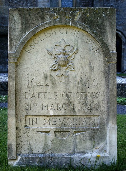
Battle of Stow on the Wold
21st March 1646
Name: Battle of Stow on the Wold
Date: 21 March 1646
War period: The Civil Wars
Start time and duration: around 5am, lasting for about an hour
Outcome: parliamentarian victory
Armies and losses: Royalist army of 2-3,000 men commanded by Sir Jacob Astley; Parliamentarian army of around 1,600 horse and 1,100 infantry commanded by Colonel Thomas Morgan. Losses: Royalist: 200 killed, 1,700 captured; Parliamentarian: few
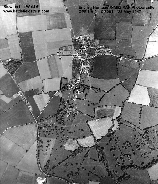
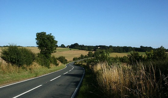
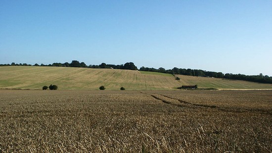
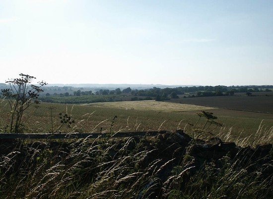
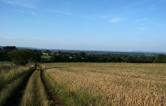
Location: Traditionally located on the the Horsington Hill ridge at Donnington though archaeological survey indicates it took place nearer the town. It was fought over open fields and within the town itself.
Map details: Grid Reference: SP 18820 26680 (418820 , 226680); OS Landranger map: 163; OS Explorer map: 45
The last battle of the first Civil War which saw the defeat of a cobbled together royalist force by regional parliamentarian troops.
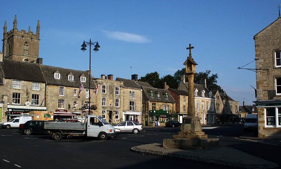
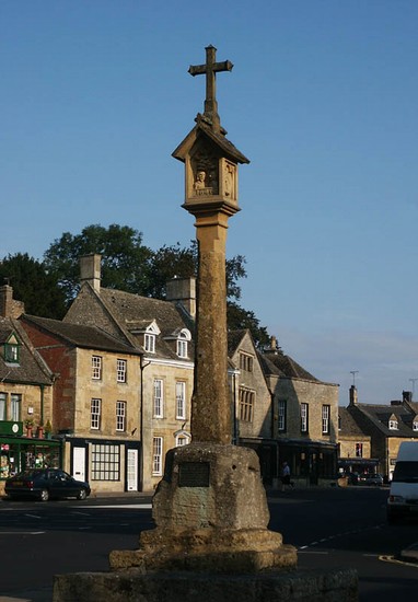
In the early morning of 21 March 1646 the last battle of the first Civil War took place in Gloucestershire, north of the town of Stow on the Wold. After initial royalist success the superiority of the parliamentarian forces, particularly Brereton’s cavalry, soon overwhelmed and routed the royalist forces. The royalists fled the field and in a running fight made their way into the streets of Stow where the final action took place, culminating in Astley’s surrender in the market square.
The destruction of the last royalist field army at Stow on the Wold dashed the last desperate hopes of the Royalist cause and effectively signalled the end of the first Civil War. Charles surrendered soon afterwards, to the Scottish army at Southwell near Newark, in May 1646.
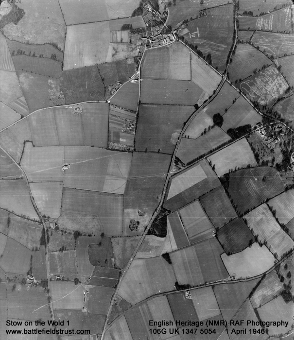
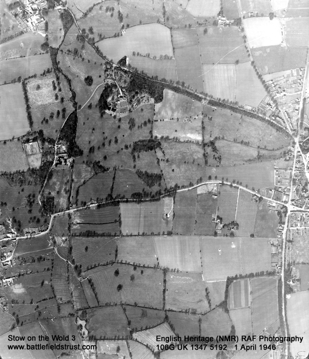
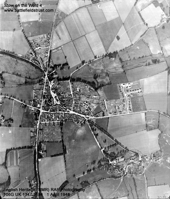
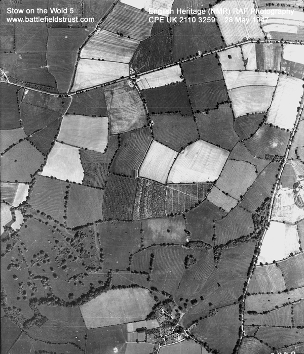
There is some dispute as to exactly where the action was fought with a number of theories put forward. The traditional site is located on the ridge to the west of the village of Donnington. Alternative sites have been suggested approximately 1500 meters north of the town or lying across the A424 or across the ridge between the A424 and the A429, the Fosse way, south of the traditional site. Survey work carried out at the traditional site, the A424 site and the ridge between the A424 and A429 by the Battlefields Trust in October 2015 and November 2022 failed to identify battlefield remains.
Other archaeological work conducted by the Battlefields Trust between 2018–2022 discovered Civil War battle related archaeology around Greenfield farm, probably representing the action on the western side of the battlefield, suggesting a battlefield area centred about half a mile (800m) north of the market square in Stow stretching from 266–300m west of the A424 on one side and the Fosse Way on the other.
Reports on the archaeological work undertaken by the Battlefields Trust, the battlefield landscape, and locating the battlefield at Stow can be found under the Media section on the left.
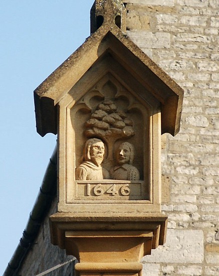
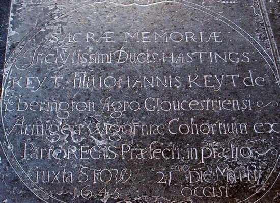
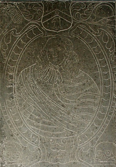
Access to the traditional site is possible by public rights of way. However the battlefield area identified between 2018–2022 can only be seen from the A424 and this busy road makes visiting the site on foot difficult and potentially dangerous. Nevertheless, it is possible to follow the route of Astley’s fighting retreat into the streets of Stow. There is the added interest of a memorial stone to one of the battle victims in the church. But most of all one must go and sit on the base of the cross in the market place, close to where Sir Jacob Astley is supposed to have sat on a drum after he surrendered, for it was here that the First Civil War was effectively ended. This event has in recent years been marked with a plaque on the base of the cross installed by the Stow Civic Society.
Historic England Battlefields Register CLICK HERE
Historic England battlefield report for Battle of Stow (-on-the-Wold) 1646


