The Battlefield
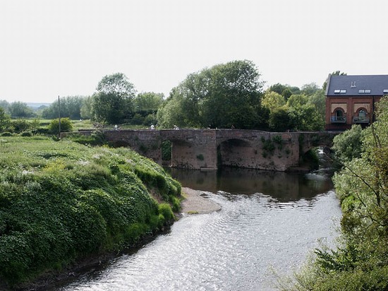
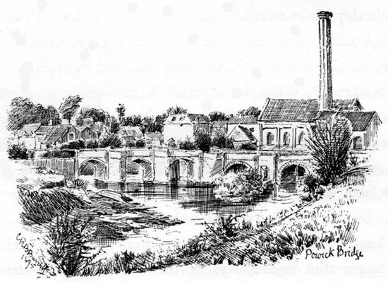
Powick bridge is still largely a medieval structure retaining the same narrow carriageway that it had in 1642. The parapet has been repaired and replaced in brick but only the two northernmost of its five arches have apparently been rebuilt. These were the ones demolished in 1651 as part of the royalist preparations before the battle of Worcester. The distinction can be clearly seen in Barrett’s drawing of 1896. Powick bridge is thus an unusual, though not unique, survival amongst battlefield bridges, most of which have been rebuilt in the centuries since. Its survival is thanks largely to the fact that it was bypassed as early as 1837, when an iron bridge was constructed over the Teme about 100 metres downstream to the east. The A449 still uses this bridge, leaving Powick old bridge for pedestrians.
The exact location and extent of Wick open field as it existed in 1642 has not been defined and thus the exact location of the action has still not been pinpointed. However the suburbs of Worcester have swamped the hamlet of Lower Wick during the 20th century and so most if not all of the battlefield, other than the meadows immediately adjacent to the bridge, has been built over.
The same ground was fought over during the far larger battle of Worcester and so any archaeology that may have survived from the skirmish will have be completely swamped by the archaeology of the 1651 battle. It is unclear whether any mass grave from the action should be expected on the battlefield, because at least some of the bodies are said to have been buried in St John’s after the battle.
Though archaeology and terrain may be almost completely lost, a far better understanding of the nature and exact location of the action should be possible through a reconstruction of the historic terrain of the battlefield as it was in 1642. This Is particularly relevant given the detail provided by the contemporary accounts which give a number of clear topographical details that should be identifiable. Using historic maps and documents, together with high resolution modern mapping of the relief, where it has not been heavily distorted by modern development, it should be possible to build up a picture of the extent and character of the hedged enclosures and open field of Lower Wick, which was a hamlet between Powick bridge and the suburb of St Johns.


