click here to print

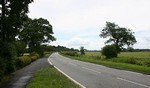 The road between the two heaths
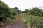 An abandonned section of the main road between the heaths
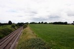 The rising ground where the two armies first clashed
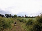 Enclosed fields near Waverton restricted cavalry action
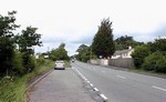 N edge of the former Hatton Heath
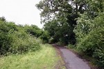 Abandonned section of main road where it passed from Hatton Heath into the enclosures.
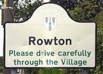 Rowton village sign
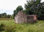 A ruined building on the former moor used as a makeshift hospital, according to tradition.
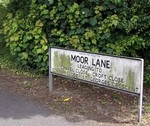 Development is creeping ever closer to the battlefield.
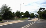 The A41 where it enters the former moor.
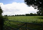 The undeveloped heart of Rowton Moor
 Rowton Lane which runs through the centre of the former moor.
 N. edge of the former Hatton Heath in the foreground with the enclosures of 1645 beyond the first hedge.
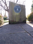 Rowton Heath memorial situated at the junction of Greenfields Lane and Claypits Lane
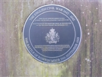 Rowton Heath memorial erected in 1995 on the 350 anniversary of the battle.
 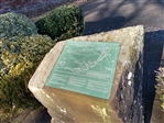 Rowton Heath memorial. Map showing the detail of the battle.
Battle of Rowton Heath
24th September 1645
The battle of Rowton Heath took place some 2 miles to the south-east of Chester on 24th September 1645, within sight of the city defences. This was a mainly cavalry action lasting sporadically over a whole day and extending across at three main locations, as the royalist forces were forced to fall back towards the city. Viewing the battlefield from the Phoenix Tower on the walls of Chester, Charles I saw his last substantial body of cavalry comprehensively defeated.
The battle of Rowton Heath destroyed the tattered remnants of the royalist Northern horse and ended Charles hopes of uniting with Montrose’s forces in Scotland. Though unbeknown to Charles, prior to Rowton, Montrose had already suffered a crushing defeat at Philiphaugh, and thus the royalist cause was already doomed.
The battle of Rowton Heath occurred in three stages and covered a very wide area. The site of the initial stage of action is the best preserved and survives as largely undeveloped agricultural land, though it is bisected by a railway line and partly disturbed by a small area of quarrying. Unfortunately the quarry is located on the possible site of the initial royalist deployments, thus probably having destroyed elements of the battle archaeology. Whitchurch Road (A41), the ‘narrow lane’ in which the fierce first engagement occurred, remains largely on its original course but has been widened and realigned in part. There is a footpath along the roadside allowing the visitor to follow the course of the initial parliamentarian advance and engagement and access to the abandoned original road is possible. Footpaths also allow access to the fields on either side of the road.
The second stage of action on Rowton Heath itself is bordered on the west by Rowton Lane, probably in existence at the time of the battle, and on the east by the later Shropshire Union Canal. Within this zone there are large areas of undeveloped agricultural land but with development on the west side of Rowton Lane and the east side of the A41, which cuts through the centre of the site. Access here is largely by the main and minor roads. The final scene of action, within the early suburbs of Chester, has been absorbed in modern development. A memorial to the battle is located at the junction of Claypits Lane and Greenfields Lane in Rowton.
- Historic England Battlefields Register CLICK HERE
- Historic England battlefield report for Battle of Rowton Heath 1645
© 2004 The Battlefields Trust.
This website was created with the support of the Heritage Lottery Fund and the Hartnett Trust